

Every summer for the past 5 years, the challenge proposes to discover 5 summits in Charlevoix (https://defides5sommets.com). It’s simple, each summit is decorated with a sign with which you have to take a selfie (the proof of your accomplishment). Then, all you have to do is register on the website and upload your five photos. Those who take the challenge have the opportunity to win a prize from an impressive list and receive the secret information for a sixth hike, a mystery summit. Also, in parallel, the Opération Protection contest is taking place, which asks you to publish a photo (with @defides5sommets and #operationprotection) that respects one of the 7 principles of “no trace” in nature (https://defides5sommets.com/concours-opération-prot). My girlfriend and I decided to use five days of our vacation to run and hike all 5 summits.
DAY 1 – Mont À Liguori (15.4 km, 782 m)
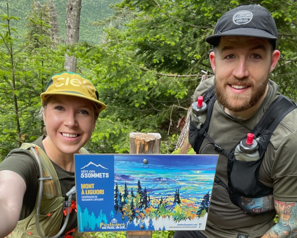
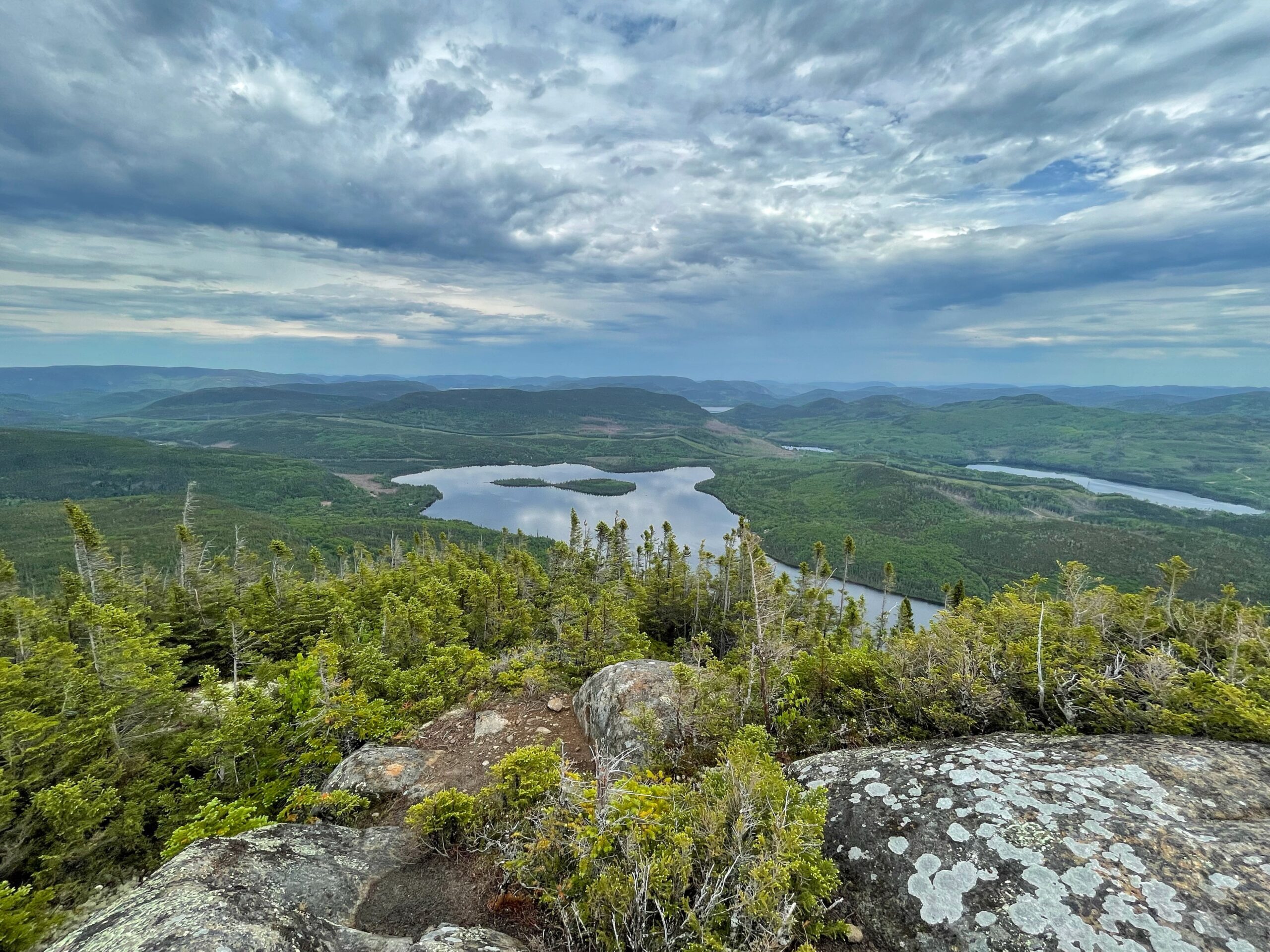
Mont À Liguori is located behind the Massif de Charlevoix, a splendid ski resort. You have to start from the Coopérative de solidarité L’Affluent. It is recommended to donate $5 per person to allow the maintenance of the trails. This hike is a classic between Quebec City and Charlevoix since it is one of the few to allow an ascent of more or less 800 meters in Quebec. Thus, in terms of difficulty, this hike is right up there with the Acropole des Draveurs (Charlevoix) and Mont-Albert (Gaspésie). Its interest also comes from its breathtaking view of the St. Lawrence River.
We started around 3pm and it took us a total of 3 hours to do the hike and take a few pictures. We did the ascent by hiking at a steady pace and the descent by running. The recommended time is more around 4-6 hours. Also, for the more spirited, the steepness of the ascent makes it very difficult to run, even impossible at times. For us, it was a very nice hike that is a challenge while remaining pleasant. Be warned, at the top the wind can be very strong.
DAY 2 – Le Pioui (10.4 km, 480 m)
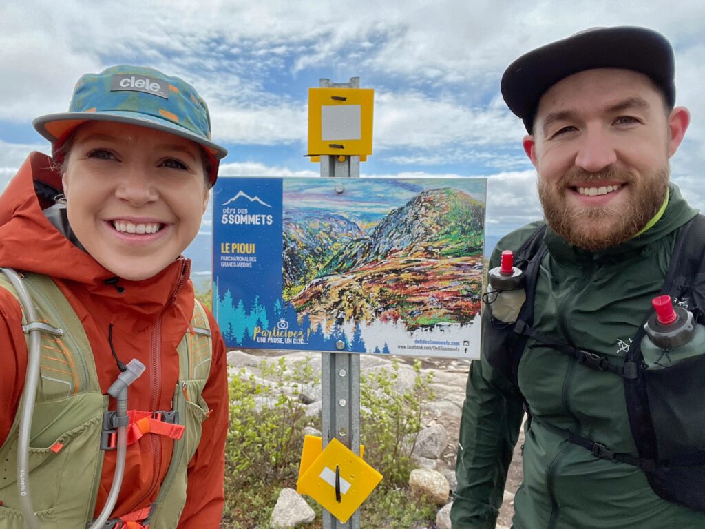
Le Pioui allows you to tour the Parc national des Grands-Jardins on a trail that is sometimes very easy and sometimes very technical. If you don’t have the annual card, you must purchase your access rights on the website prior to your visit ($9). The ascent ends after about 4 km and gives way to an infinite view on the mountains of the area and a few kilometers through the bog. After 6-7 km, it is possible to add a 1.2 km round trip to reach the famous summit Mont-du-Lac-des-Cygnes. Even though this addition has nothing to do with the challenge, it seems impossible not to do it. Mont-du-Lac-des-Cygnes is very popular and is one of the most beautiful places to take pictures while hiking in Quebec. The only downside is the end of the trail; the descent is sustained on a gravel path not very pleasant for the knees.
This hike was very similar to the previous one for us. We started around 9am and completed the trail in 3 hours including the ascent to Mont-du-Lac-des-Cygnes. The recommended time is more around 5 hours. At the top the wind was very strong, which seems to always be the case. Even on a very hot day, I recommend bringing a windbreaker. Again, we climbed at a good pace and ran on the summit plateau and downhill. Afterwards, we used the facilities to have a lunch at the foot of the mountain.
DAY 3 – Le Menaud (7.6 km, 343 m)
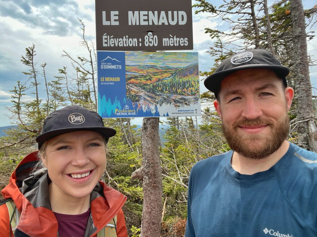
Le Menaud is the new brother of Mont Élie. The attractions of this hike are a 25-meter waterfall at the halfway point and a panoramic view from the summit. The hike is located in a ZEC (Zones d’Exploitation Contrôlée – Controlled Exploitation Zones), so there is a $10 fee per vehicle. It also takes about 45 minutes of driving through the ZEC before you get to the start of the hike. The area is known to be muddy, so be prepared.
When traveling or during an adventure, there are lows. Our day at Le Menaud was one of them. First, according to Google Maps, we had to drive 6 minutes through the woods to get to the trailhead. In reality, it was more like 45 minutes on a fairly rough trail at times. So, plan an hour and a half drive (round trip) from the main office. Then, at around 11am we started this hike under the rain with our raincoat, but the temperature climbed quickly. Eventually, the trail was very muddy making many sections very slippery on the way up, and even more so on the way down. For us, it was not a pleasant hike. However, I still think that the two visual attractions, the waterfall and the panoramic view, are worth the detour. It was the kind of hike we did for the view, not for the trail. Also, don’t underestimate this hike. We thought it would be our easiest because of the distance, but it may have been our hardest. My Suunto 9 calculated 6.4 km and 415 meters of ascent in 2 and a half hours. The recommended time is more around 4 hours. We did not run any sections.
DAY 4 – Mont Grand-Fonds (9 km, 335 m)
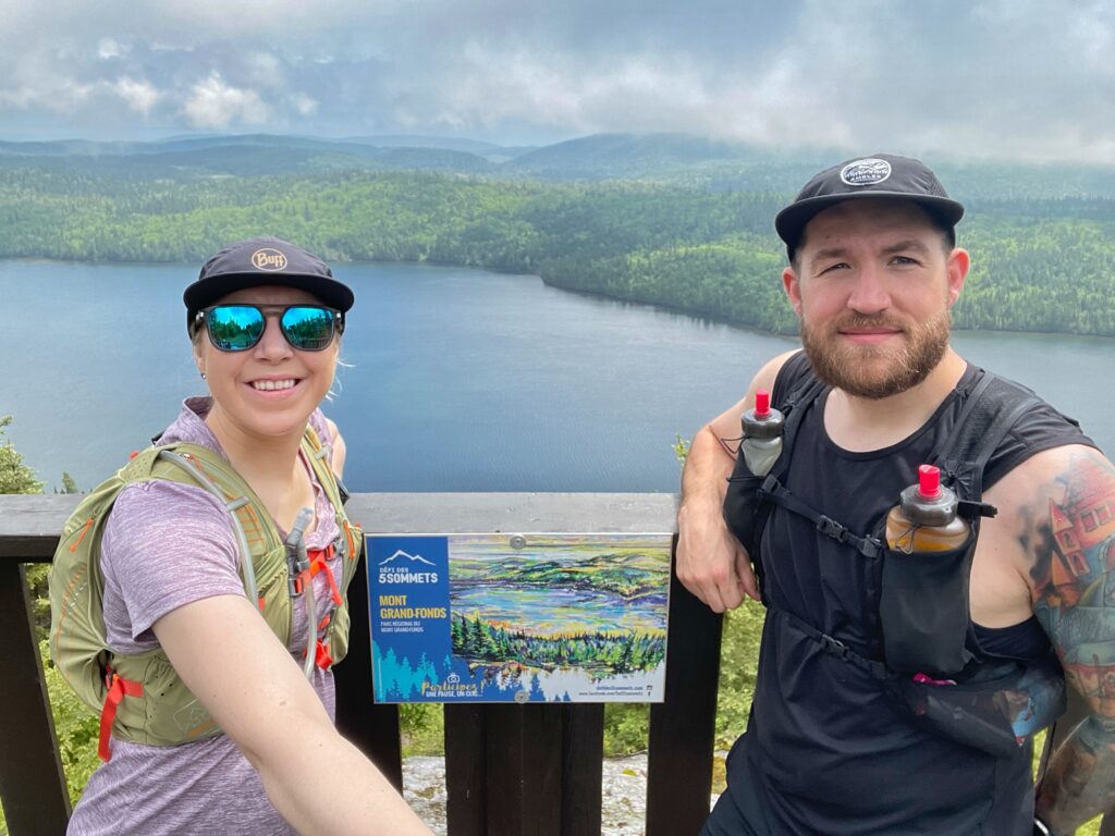
Mont Grand-Fonds is the ski resort of the people of La Malbaie. A fee of $10 per person must be paid at the reception. The hike culminates in a breathtaking view of Lake Gravel. Overall, the route is fairly easy and not very technical.
For us, Mont Grand-Fonds was a relief after our wet day at Le Menaud. At 10:30 we started the trail that goes through the woods with a gradual ascent. It is the kind of hike where you can talk about anything and everything like during a walk in the park. We did the trail in 2 hours without running but this trail seems perfect for those who want to trail run. The recommended time is 3-4 hours. The trail doesn’t offer anything too extraordinary, but the view of Gravel Lake is incredible.
DAY 5 – L’Orignac (16.2 km, 420 m)
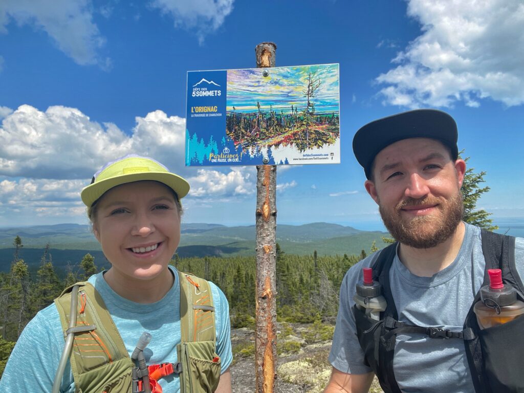
L’Orignac is a hiking sector near Saint-Siméon managed by the organization La Traversée de Charlevoix. However, don’t get me wrong, the trail proposed here is not part of the 105 km long-distance trail La Traversée de Charlevoix. This section of the trail can be seen as an extension. The challenge proposes to start from Camp Arthur Savard and a donation of $5 per person is recommended. From there, you must follow the Orignac Centre trail. The departure is around kilometer 17 and the summit where you can have a clear view of the St-Lawrence River is around kilometer 10. The trail is never too difficult, but the kilometers that accumulate make it a hike not to be taken lightly.
L’Orignac was the conclusion of our challenge. Overall a nice trail, quite long with many mosquitoes, but never too difficult. I have put the Orignac sector among the places I want to redo in trail running. We completed the hike in 3 and a half hours, but the recommended time is 4-5 hours. Note that my Suunto 9 calculated about 3 km less than expected. Thus, I believe that in fact, this hike is shorter than advertised. After our hike, we headed to the Haute Côte-Nord and stopped at Microbrasserie de Tadoussac to celebrate with a beer and a poutine.
In total, my Suunto 9 shows 55.22 km and 2,634 meters of ascent for the 5 summits. For those who are thinking of doing the challenge, it is important to know that with the exception of Mont Grand-Fonds, the trails chosen this year are classified as difficult and can become a nightmare for those who venture out without really knowing what to expect. Be prepared, heat, rain, wind, hydration and even mosquitoes are all factors that can affect the experience and make the hike longer and more difficult. For us, it was a great first experience that will really end during the summer as we plan to do the mystery summit in the next few weeks.


